Fahrguide für den Grimselpass: Seen, Kehren und alpine Ingenieurskunst
Plane einen richtigen Grimselpass-Roadtrip – vom Granit- und Stausee-Aufstieg bis nach Gletsch – mit lohnenden Stopps, Routenvorschlägen und wichtigen Zugangsinformationen für 2027.
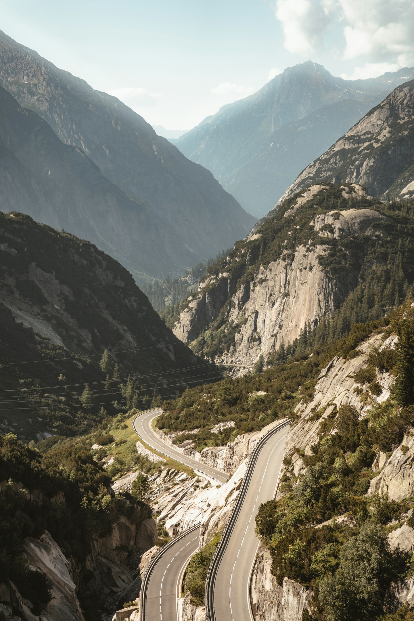
Grimsel has a rather particular idea of a scenic drive. It starts with a valley, adds a few bends, then replaces the comforting greenery with vast slabs of granite and reservoirs that look almost too blue to be real. By the time the road reaches the summit, the scenery has become so architectural that your car feels like a small component in a much larger machine.
That is its appeal. Grimsel combines a satisfying mountain crossing with an unusually visible story about water, electricity and the engineering required to make a living in the Alps. You can enjoy the road in an ordinary hatchback, spend a day investigating its dams, or make it the centrepiece of a grand tour. The trick is deciding which kind of day you want before every tempting turn-off makes the decision for you.
Where is Grimsel Pass, and what does the crossing involve?
Grimsel connects Innertkirchen in the Bernese Oberland with Gletsch in Valais. The summit is approximately 2,164 metres above sea level. From the north, the route follows the Haslital through Guttannen before climbing into the reservoir country around Handeck, Räterichsbodensee and Grimselsee. Beyond the summit, a much shorter sequence of hairpins descends towards Gletsch.
Those endpoints matter. Meiringen is a useful base near Innertkirchen; it is not the northern end of the pass itself. Andermatt lies beyond the neighbouring Furka Pass. Likewise, the Rhone Glacier visitor area belongs to a Furka excursion, rather than a stop directly beside the Grimsel summit. Getting the geography straight saves a surprising amount of holiday improvisation.
For a first visit, allow a generous half-day for the crossing, a meal and a handful of short stops. That is our planning recommendation, not a measured driving time. A substantial hike, a cable car ride or a guided power-station visit changes the scale of the day. Treat one of those as an activity in its own right, with the road connecting the chapters.
Check the pass, then check the places you want to visit
Grimsel is seasonal. Summer into autumn is the normal driving window, but snow clearance, fresh snowfall and temporary restrictions determine whether you can cross on a particular date. A village being accessible does not mean the summit road is open. Use the Grimsel pass-status page immediately before travelling and read the actual restriction text, as well as the headline status.
September can suit a driving trip beautifully: there is still useful daylight, and a flexible itinerary can take advantage of clear spells. It is also high enough here for a mild valley morning to become a cold summit afternoon. Do not build a non-refundable chain of activities around an assumption that an autumn date guarantees summer conditions.
The attractions have separate operating calendars. A road opening does not automatically open every railway, hotel or walking route. This distinction is particularly important in 2026: the Oberaar panoramic road is closed for the entire summer season, while construction also affects access around the Gelmerbahn. The main Grimsel crossing and those side trips should be checked individually.
An early departure is useful if it gives you a relaxed day. There is little advantage in chasing sunrise through darkness, fog or possible frost simply because a photograph looked wonderful online. Choose light and conditions you can enjoy, then leave enough flexibility to pause when the mountain supplies something worth looking at.
Which direction should you drive?
Innertkirchen to Gletsch: the gradual reveal
This is our preferred introduction. The longer northern approach gives the scenery room to develop: settlement, valley, rock, reservoirs, summit. You also meet several potential stops before committing to the final climb, which makes it easier to shape a mixed driving-and-exploring day. The descent towards Gletsch then supplies the compact, unmistakably Alpine finale.
It works especially well if you are staying around Meiringen or continuing into Valais. If you plan to drive Furka afterwards, make that decision at Gletsch with the weather, time and your concentration in mind. The neighbouring road will still be there on a second day.
Gletsch to Innertkirchen: hairpins first
Approaching from Valais reverses the storytelling. The road climbs promptly out of Gletsch, reaches the summit, then unwinds into the larger reservoir landscape on the Bernese side. This direction suits a journey arriving from Oberwald or Furka, and gives you the choice of stopping for lunch lower down rather than squeezing it between two summits.
Neither direction supplies exclusive scenery. A change of light often matters more than a compass bearing. Pick the direction that fits your accommodation and onward journey, especially if taking the other way would mean a long, tired transfer at the end.
The drive, from valley floor to summit
Innertkirchen and Guttannen: settle into the day
Innertkirchen is the important junction where plans separate towards Grimsel or Susten. Set your route deliberately before leaving: automatic navigation tends to optimise arrival time, which may have very little to do with your intentions. If the aim is the pass, include the summit as a waypoint rather than assuming the quickest route will understand.
Through the inhabited lower valley, let the pace remain unhurried. This is where you establish how the car feels, whether your passenger is comfortable and whether the day's weather matches the forecast. A short pause in Guttannen can be more useful than arriving at the first major attraction already watching the clock.
Handeck: decide whether today includes the Gelmerbahn
The Gelmerbahn is a former works railway offering an open-carriage ride up to Gelmersee. Its maximum gradient is 106 per cent, which is a gradient measurement, not an angle in degrees. The sensation is quite sufficient without improving the mathematics. For 2026, the operator lists a season from 6 June to 25 October and recommends booking ahead.
There is an important practical update. Construction means the current approach from the parking or PostBus stop involves steep steps and temporary paths, with roughly 15 minutes to reach the railway. The operator also states that the dam wall is not walkable during summer 2026; the circular lake trail has an alternative alignment in front of it. Check the current Gelmerbahn information before choosing your times.
This is a worthwhile main activity if your group wants to get out of the car. It is a poor choice as an impulsive ten-minute stop. Build in walking time, the return journey and some breathing room before the next reservation.
Räterichsbodensee: the scenery changes scale
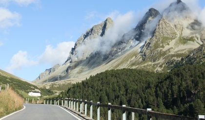
Higher up, the reservoir and surrounding granite make the route feel markedly different from the valley below. Water, road and bare rock create strong lines across the view. This is a good moment to stop at an authorised parking place and take in the composition before trying to photograph it.
For the driver, the pleasure lies in the changing sequence of bends and the way the landscape opens between them. Resist the temptation to treat an open-looking section as a promise about the next corner. The road continues to serve buses, cyclists, motorcyclists, workers and other visitors. A convincing mountain drive feels composed from the passenger seat too.
Grimselsee and the Hospiz: take the engineering seriously
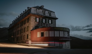
Grimsel Hospiz stands above Grimselsee and makes a natural focal point for a longer pause. It is separate from the accommodation and restaurants at the pass summit. If you have booked lunch or an overnight stay, check that your navigation is taking you to the correct property; “somewhere at Grimsel” is not an address.
The lake and dams reward a little attention even if engineering is not usually your holiday subject. Look at how the structures meet the rock, then imagine the access, materials and working seasons required to build them. Suddenly the impressive machine parked behind you seems relatively easy to assemble.
Totensee and the summit: a proper pause before Gletsch
The summit area, around Totensee, offers the sense of arrival that a mountain crossing deserves. Park, step away from the traffic and give yourself time to notice the view. Conditions can feel exposed here, so keep a warm layer accessible rather than underneath every bag in the boot.
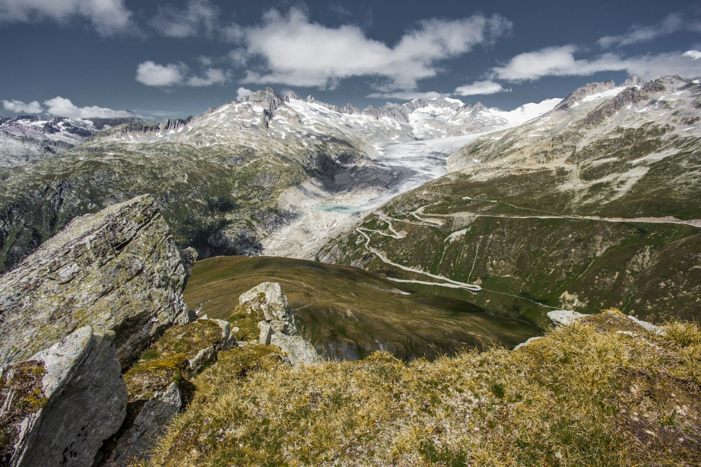
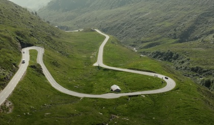
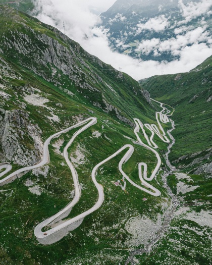
The road towards Gletsch folds down through a series of hairpins, with the wider mountain-road network becoming apparent across the valley. Enjoy the geometry from a suitable stopping place, then give the descent your attention. At Gletsch, choose between continuing down towards Oberwald or climbing again towards Furka. It is a useful decision point, not merely an intersection to sweep through.
Why the dams belong in your Grimsel story
The reservoirs are working infrastructure. They store water within the Kraftwerke Oberhasli system, and their appearance can change with operations and conditions. A photograph showing a particular water level should not become an expectation that the same shoreline will greet you on arrival.
One major recent development is the replacement Spitallamm dam. KWO built a new wall immediately in front of the ageing original and inaugurated it on 20 June 2025. The completed replacement and the separate proposed enlargement of Grimselsee are different projects. Describing everything here as one endless construction site misses what has actually changed.
For more context, look at the operator's guided visits. Its programme includes opportunities to explore the area's power infrastructure with people who can explain what happens beyond the visible concrete. Pick a specific tour, check the language and meeting point, and let its timetable shape the driving day. An hour spent understanding the landscape often adds more than another hurried viewpoint.
Oberaar in 2026: take the cable car, not the closed road
The panoramic road to Oberaar frequently appears in older Grimsel itineraries. For summer 2026, Grimselwelt explicitly states that both the road and Berghaus Oberaar are closed because of works. Do not use the usual alternating traffic schedule as evidence that you can drive it: the seasonal closure takes precedence.
The Oberaarbahn is the published alternative, with a 2026 operating period of 26 June to 4 October. It connects the area from Grimsel Hospiz. Check the Oberaar access notice and the cable car's own timetable before making plans.
For a driving-focused visit, the simplest choice may be to leave this excursion for another day. If Oberaar is your priority, remove something else from the itinerary and plan food accordingly; the closed Berghaus should not be pencilled in as your lunch stop.
Choose a day that matches your interests
A relaxed first crossing
Start from Meiringen or Innertkirchen after breakfast, with fuel or charge already sorted. Drive through Guttannen, take a short reservoir stop and give the Hospiz or summit area the main pause. Continue to Gletsch, then finish in Valais or return over the same pass while you are still fresh. Reversing the road changes the view enough to make a return journey worthwhile.
This plan deliberately leaves space for the unexpected: a better lunch, a longer conversation or the sort of light that makes everyone put their phones down for a moment. It also works for mixed-interest groups, because the day is not built entirely around the person holding the steering wheel.
A day for curious engineers
Choose a guided KWO visit as the anchor, then arrange your crossing around its confirmed departure. Keep photography stops short before the appointment and save the longer wander for afterwards. This version gives Grimsel a clear theme: how people have adapted a difficult mountain landscape to store and produce energy.
A two-day Alpine weekend
Spend the first day on Grimsel with either the Gelmerbahn or a guided visit. Stay in a confirmed operating property in the region, then use the next day's conditions to choose Furka, Susten or a lower-level alternative. Two days make it possible to enjoy a substantial activity without treating dinner as the finish line of an endurance event.
The right car is the one you can enjoy comfortably
You do not need a supercar to make Grimsel worthwhile. A car with good visibility, predictable controls and room for your passengers can be ideal. If you are hiring something special, become familiar with its dimensions, gearbox and parking behaviour before the climb. A spectacular badge offers no help when you cannot judge the front corner beside a stone wall.
In a manual, use suitable gears on the descents rather than repeatedly gathering speed and braking it away. In an automatic, understand the available downhill control before setting off. For a classic, address known cooling or braking issues at home and avoid making the itinerary depend on a pace the car cannot comfortably sustain.
Electric cars suit the smooth delivery of a mountain climb, but the energy plan should include a margin. The ascent costs energy; the descent can recover some, with the amount depending on the car and conditions. Follow the manufacturer's guidance on regeneration and remember it may be limited by battery state or temperature.
Grimselwelt lists paid charging at its Innertkirchen headquarters, Hotel Handeck and Grimsel Hospiz, using ChargeOne. It also says chargers cannot be reserved and availability is not guaranteed. Check compatibility, access and alternatives before relying on one. Charging over lunch can fit the day neatly; arriving with no workable fallback cannot.
Photograph the place, not just the car
Grimsel gives you three useful visual subjects: the road's shape, the scale of the reservoir landscape and the relationship between machinery and rock. You do not need all three in every frame. One broad landscape photograph and one carefully parked-car image often tell the story better than twenty nearly identical shots.
Choose legitimate parking first, then explore the composition on foot. Keep access routes and spaces usable for other visitors. If the car park is busy, photograph the landscape instead of waiting for strangers to leave your imaginary studio. Cloud can add texture, but mist that removes visibility is a reason to simplify the drive, not a challenge to overcome for content.
Continue with Furka and Susten, or save them
A complete loop can run from Innertkirchen over Grimsel to Gletsch, across Furka towards Andermatt, down through Göschenen to Wassen, then back over Susten. Those connecting towns are part of the journey; the three pass summits are not adjacent attractions in a theme park.
Use our Furka Pass driving guide and Susten Pass driving guide to judge what deserves its own time. A major hike or guided visit on Grimsel is a good reason to split the loop. Every pass also needs its own access check.
If you would like someone else to shape the wider trip, explore driving tours and road rallies on Petrolbase and compare the published routes and inclusions. Choose a listing that explicitly matches your plans; being in Switzerland does not mean a tour visits Grimsel.
Give Grimsel time to change character as you climb. The road supplies the corners; the granite, water and engineering supply the reason to remember them.
Häufig gestellte Fragen
Hast du Fragen?

-thumb.jpg)