Oberalp Pass Driving Guide: The Road, Lake and Rhine-Source Stops
Plan a rewarding drive from Andermatt to Disentis via Oberalp Pass, with summit stops, seasonal advice, the Rhine-source hike and practical route ideas.
The first surprise on Oberalp Pass is how quickly the day changes. Andermatt drops behind you, the Ursern Valley opens below, and a railway starts sharing the same improbable route into the mountains. Then a lake appears, followed by a red lighthouse. At more than 2,000 metres, the last of those requires an explanation.
Oberalp rewards drivers who enjoy the whole journey: the climb, the pause at the top and the gradual arrival in another part of Switzerland. It links Uri with Graubünden, bringing you from Andermatt towards Sedrun and Disentis/Mustér. There is proper Alpine driving here, without needing to build your holiday around the tightest corner or the most intimidating photograph.
This guide helps you choose a direction, understand the seasonal access, find worthwhile stops and build an itinerary that actually works. The aim is a day with enough space for the scenery, your passengers and perhaps a second coffee. The car gets plenty to do.
Oberalp Pass: the route at a glance
Main journey: Andermatt, Oberalp Pass, Tschamut, Sedrun and Disentis/Mustér. The summit is roughly 2,045 metres above sea level; official sources variously publish 2,044 and 2,046 metres. You may see either figure on maps and tourism material.
Time to allow: treat an Andermatt-to-Disentis outing as a half-day experience with stops, rather than a navigation app's uninterrupted driving time. Add considerably more time for hiking. This is our planning recommendation, not a guaranteed journey duration.
Access: the road has a winter closure. Check the current Oberalp road report before travelling, including restrictions and temporary closures. A train crossing the pass does not mean cars can cross it.
What the drive feels like, section by section
Andermatt to the summit: the climb with a view
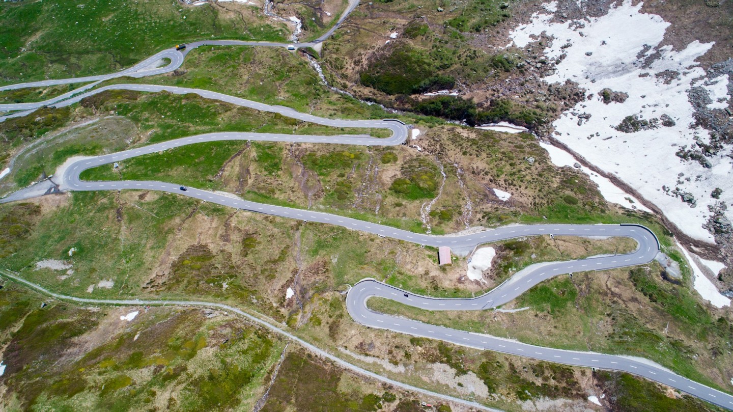
Starting in Andermatt gives the outing a satisfying beginning. You leave a recognisable mountain village and climb towards a landscape that becomes increasingly open. The views back into the Ursern Valley help you understand the elevation you have gained, while the railway adds movement and scale.
Give yourself time to settle into the car before deciding what sort of driving day this will be. A familiar hatchback can feel different when fully loaded on a climb; a powerful grand tourer still needs room to turn and stop. The rewarding part is anticipating the road well, choosing a comfortable gear and arriving at each bend composed.
The western approach includes covered sections alongside the mountain corridor. Expect changes in light and surface conditions rather than assuming everything will match the sunny stretch behind you. Keep attention on the lane, especially when a train or a sudden view makes the passenger reach for a camera.
The summit: a proper pause
The pass does not deliver a single spectacular corner and then send you straight home. The lake, station, buildings and lighthouse make the summit a destination in its own right. That is why Oberalp works particularly well for a mixed group: a keen driver gets a mountain road, while everyone else gets a reason to leave the car.
Find a permitted parking space before exploring. A summit visit is much better when you can put the keys away for a while. Allow for wind and a noticeable temperature change; the jacket that seemed unnecessary in the valley often earns its place here.
Tschamut, Sedrun and Disentis: keep going east
On the Graubünden side, the route descends through Tschamut and continues towards Sedrun, then Disentis/Mustér. The mountain crossing becomes a journey through the Surselva. Villages and local traffic change the rhythm, and the surroundings deserve the same attention as the high section.
Resist the temptation to treat Sedrun simply as the place where the entertaining bit ends. A relaxed meal, a short village walk or an overnight stop gives the eastern side a place in the trip. In Disentis, the monastery offers an obvious cultural counterpoint to the morning's automotive interests.
Which direction should you drive?
For a first visit from central Switzerland, we would start in Andermatt and continue east. It makes the transition easy to follow: the Ursern Valley, the high lake, then the villages of Graubünden. Stop at the summit before descending, so nobody spends the second half of the drive negotiating for the photograph you passed.
From Chur or the Surselva, the opposite direction makes more sense. Climbing from Disentis through Sedrun brings you towards the lake before the descent into Andermatt. You arrive at a useful base for another day's mountain driving, rather than finishing far from your accommodation.
An out-and-back journey is perfectly worthwhile. The views unfold differently in reverse, and returning over the same pass keeps the plan manageable. Decide your turnaround point before leaving: the summit makes a short excursion; Disentis creates a fuller day. Avoid adding a huge return loop just because drawing a circle on a map feels tidier.
The summit stops worth making
Oberalpsee: the roadside lake
Oberalpsee sits at the summit area and provides the easy lakeside pause most visitors imagine when planning this drive. Take a short walk on an appropriate path, find a view away from the parked cars and enjoy the changing colours across the water.
In photographs, a calm lake can appear almost unreal. In person, weather supplies the personality: sunlight one moment, cloud and ripples the next. Give yourself a little flexibility rather than waiting for one perfect reflection while the rest of the day slips away.
The lighthouse: a connection to the North Sea
The red lighthouse represents the Rhine's journey from the Alps towards the Netherlands. It is a replica linked to the historic light at Hoek van Holland, near the river's mouth. That makes its apparently misplaced nautical presence rather wonderful. Very few mountain coffee stops invite a conversation about Rotterdam.
However, the lighthouse is a symbol, not a marker showing water emerging from the ground beneath it. The celebrated Rhine-source visit is to Lake Toma, also called Tomasee or Lai da Tuma, away from the road. Keeping those places separate will make your itinerary considerably more accurate.
A railway that belongs in the landscape
The Matterhorn Gotthard Railway crosses Oberalp, and the Glacier Express reaches its highest point here. Seeing a train move through the same landscape gives perspective that a parked car cannot. Enjoy it from a public viewing area, away from tracks and railway operations.
For a travelling group with different interests, the railway also suggests a useful idea: one day driving, another travelling as a passenger. Check the operator's timetable for that second outing. A scenic railway experience is a separate plan, rather than an assumed vehicle-transfer service.
Lake Toma requires a hiking plan
Lake Toma is frequently presented as an extra stop on an Oberalp road trip. That description can hide the important detail: you walk there on a mountain trail. It is not the lake beside the car park, and it should not be squeezed between a summit photograph and lunch in Disentis.
There is also a significant 2026 update. Following a rockslide affecting the original trail, the tourism organisation announced a replacement route on 13 July. Its official trail update says the new alignment adds around 30–40 minutes in total. The linked route currently shows approximately 9.7 kilometres and four hours.
Use the current route description, weather and your group's ability to decide whether to include it. Take proper walking footwear and mountain clothing, and leave enough daylight and energy for the drive afterwards. If the purpose of the day is driving, the summit lake and lighthouse already make a satisfying visit. Save Lake Toma for a day that gives the walk the attention it deserves.
When to go, and how to check the conditions
Plan around the snow-free road season, broadly summer into autumn, while recognising that the actual opening and closing dates vary. Early access can bring snow banks, meltwater and maintenance work. Later trips can bring cold mornings and early snowfall. A month written in a guide is a planning clue, not permission to cross.
July and August offer long daylight hours, useful when the summit stop becomes lunch and lunch becomes a walk. They also attract other visitors. Starting earlier can give you more flexibility, but an early departure should still follow a weather check; arriving first is no advantage if visibility is poor.
September can be particularly appealing for softer light and a less hurried mood. Choose the forecast over the calendar, and do not assume the next pass on your itinerary has the same conditions. Oberalp, Furka and Gotthard have separate reports for a reason.
Before leaving, check the road report, summit forecast and return route. Repeat the check if conditions change during a long stop. The Canton of Uri's road information is another useful starting point. Local signs and closures take priority over a saved navigation route.
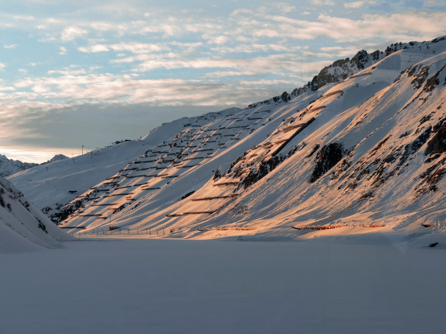
In winter, the mountain remains a destination, but the road trip changes fundamentally. Rail access and winter activities are separate from driving over the summit. Do not plan a car crossing from a snowy railway photograph, however inviting it looks.
A half-day drive and a fuller weekend
The straightforward first visit
Begin in Andermatt after checking the weather and your fuel or battery level. Drive to the summit, park and allow an unhurried break around Oberalpsee and the lighthouse. Continue through Sedrun to Disentis for lunch, then decide whether to return over Oberalp or stay on the eastern side.
For the return journey, set a latest comfortable departure time before lunch. This keeps a pleasant afternoon from turning into a reluctant drive in darkness or deteriorating conditions. If travelling with children or anyone sensitive to winding roads, make the summit and village stops part of the plan from the start.
The weekend with breathing space
Stay in Andermatt or the Sedrun–Disentis area, depending on the direction you are travelling. Give the crossing its own day, with time for a longer stop at either end. A second day can focus on hiking, railway travel or another drive, chosen after seeing the weather.
When comparing accommodation, practical details matter: parking access, a secure place for luggage, charging arrangements if needed, and breakfast times that suit your departure. For a low car, ask about garage ramps. A beautiful hotel is less charming when your first conversation concerns the front splitter.
For a group, agree on the next stop and share the route before moving. Let different drivers travel at a comfortable pace, then regroup in a suitable parking area. This produces a much better day than trying to keep every car attached to the same rear bumper.
Connecting Oberalp with other Swiss passes
Oberalp runs east from Andermatt; Furka heads west and Gotthard takes you south via Hospental. They meet in a useful touring region, but adding their names together does not automatically create a short loop. Check the complete route, including the road that brings you back.
A manageable approach is to return to Andermatt and leave the next crossing for another day. Our Gotthard Pass guide explains the choice between the cobbled Tremola and the modern road. The Furka Pass guide helps you plan the western extension.
A larger circuit can continue from Disentis over Lukmanier into Ticino, travel through Biasca towards Airolo, and return over Gotthard to Andermatt. This is a substantial itinerary with valley driving and additional mountain crossings. Assess the total distance and time in your route planner, check every pass and allow for meals, traffic and fatigue.
Continuing east through the Surselva towards Chur is another useful choice for a wider Swiss road trip. It lets Oberalp function as a journey between regions rather than forcing a return to the starting point. Book the overnight stop around the route you actually want to drive.
Choosing and preparing the car
A well-maintained everyday car can make this trip memorable. Power is less important than visibility, dependable brakes and being comfortable with the vehicle's controls. If you are collecting a hire car, spend a few minutes finding the lights, demisting controls and transmission settings before entering the mountains.
For a classic, check cooling, fluids, tyres and brakes before departure. Make the day's distance realistic for the car and its occupants. A short route enjoyed with confidence beats spending the final hour watching a temperature gauge and pretending everything is completely normal.
A sports car brings its own pleasures, especially steering feel and an engaging gearbox. It also brings practical questions about ground clearance, luggage and ride comfort. Use marked parking areas carefully, and avoid assuming a gravel shoulder is suitable simply because another car has stopped there.
Carry water, an extra layer and the details you need for assistance. Download the route, but keep the day flexible enough to follow a closure or change the destination. Preparation should give you freedom once the journey begins.
Driving Oberalp in an electric car
Plan energy around the whole itinerary, including the climb, the onward journey and an alternative if your preferred charger is unavailable. Check connector compatibility, access hours and current operating status. A charging symbol on a map is the beginning of that check.
On a descent, regeneration can recover some energy, but it does not erase the cost of climbing. Its strength can vary with battery charge and temperature. Know your vehicle's behaviour and remain ready to use the normal brakes. Select settings according to the manufacturer's guidance.
If staying overnight, confirm the hotel's charging arrangements directly: whether you can reserve a space, how payment works and whether charging is shared. Sorting those details beforehand leaves the summit stop free for the lake rather than an extended discussion with three apps.
Keep the day enjoyable for everyone
Use a pace that leaves time to react within what you can see. Stay in your lane through bends, give cyclists room and wait for a clear opportunity before passing. Villages deserve particular patience; this scenic road is also somebody's route to work and home.
On descents, manage speed early and use an appropriate gear or vehicle setting to support the brakes. If you need a rest, stop somewhere permitted and fully clear of moving traffic. Passengers will remember whether the drive felt comfortable long after they forget the car's specification.
Photographs are best planned around proper stops. Let a passenger handle navigation and moving scenery shots, then take your own photographs once parked. A strong image needs good light and a thoughtful viewpoint, not a car balanced on the edge of a bend.
Make Oberalp part of your next driving trip
For a self-planned outing, keep the first version simple: one crossing, a summit stop and a village meal. Add another activity only if it improves the day. Budget for fuel or charging, food, parking and accommodation where needed; check motorway requirements separately for your approach.
If you would prefer an organised journey, explore driving tours and road rallies on Petrolbase. Compare the actual itinerary, daily driving time, vehicle arrangements and support. Confirm whether Oberalp is included and what happens if mountain weather changes the route.
Oberalp's appeal is the variety you can enjoy in a relatively focused outing: a rewarding climb, a lake, a railway, an unlikely lighthouse and a different Switzerland on the far side. Give those details room, and the drive becomes much more than another summit photograph.
Frequently Questions People Ask
Do you have any questions?


-thumb.jpg)